Lone Star Hiking Trail | Texas’ Longest Trail Through Piney Woods
Complete section-by-section guide to Texas’ 96-mile Lone Star Hiking Trail. Find mileage, resupply points, trailhead access, and essential beginner info for this Sam Houston National Forest thru-hike.
Quick Trail Facts
Difficulty: Easy
Distance: 96.7 mi
Elevation Gain: 3,576 ft
TH1 – TH15
Average Time: 4-10 Day
Permit Required?: false
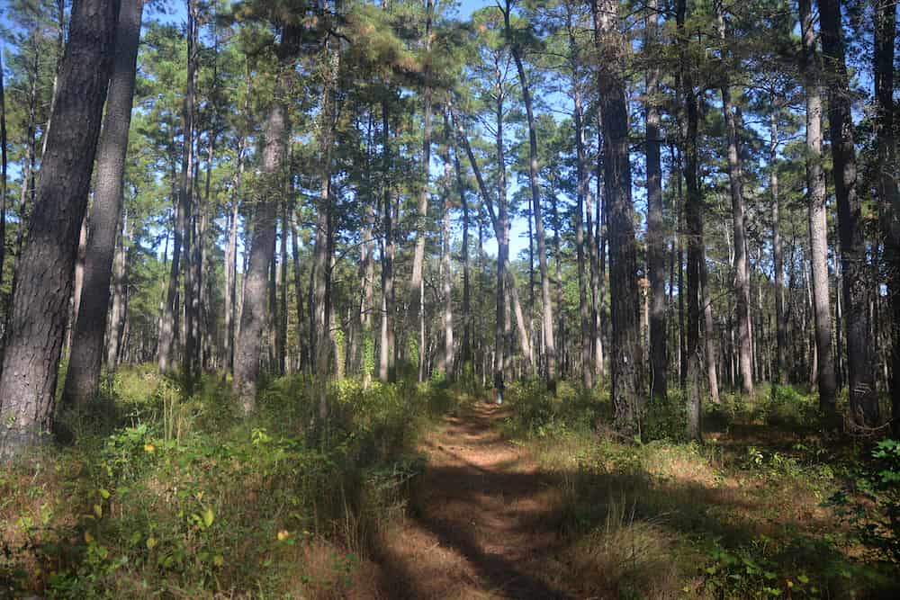
The Lone Star Hiking Trail (LSHT) is a 96-mile point-to-point trail running through the Sam Houston National Forest in East Texas, approximately 70 miles north of Houston. As Texas’ longest continuous hiking trail, it offers an accessible introduction to thru-hiking with relatively flat terrain and 3,576 feet of total elevation gain.
The trail runs from Richards (west) to Cleveland (east), divided into multiple named sections with 15 numbered trailheads providing access points. Best hiked during fall, winter, and spring to avoid oppressive heat and bugs.
Trail Sections Overview
Richards Section (Miles 0-3.45)
Trailheads: #1-#2
The westernmost section begins at FS 219/FM 149 intersection near Richards. Features early intersections with the Little Lake Creek Loop Trail and crosses through diverse pine forests.
Highlights:
Trail start at Trailhead #1
Multiple loop trail connections
Ponds for emergency water
North Wilderness Section (Miles 3.45-8.7)
Trailheads: #2-#3
Passes through the Little Lake Creek Wilderness area with clear spring-fed creeks and designated primitive camps. This section offers a true wilderness experience with minimal development.
Highlights:
Little Lake Creek Wilderness
North Wilderness Trail shortcut option
Sand Branch primitive camp (0.6 miles south via detour)
Little Lake Creek Wilderness Camp at FS 231
Water Sources:
Clear water spring-fed creek (4 D.R.O.P.S) at mile 3.95
Little Lake Creek (1 D.R.O.P.S) at mile 5.8
Pole Creek (seasonal, 1/2 D.R.O.P.S) at mile 8.0
Kelly Section (Miles 8.7-14.3)
Trailheads: #3-#5
Crosses FM 149 and features sharp turns requiring attention to blazes. Includes the southern terminus of the Little Lake Creek Loop Trail and Kelly’s Pond area.
Highlights:
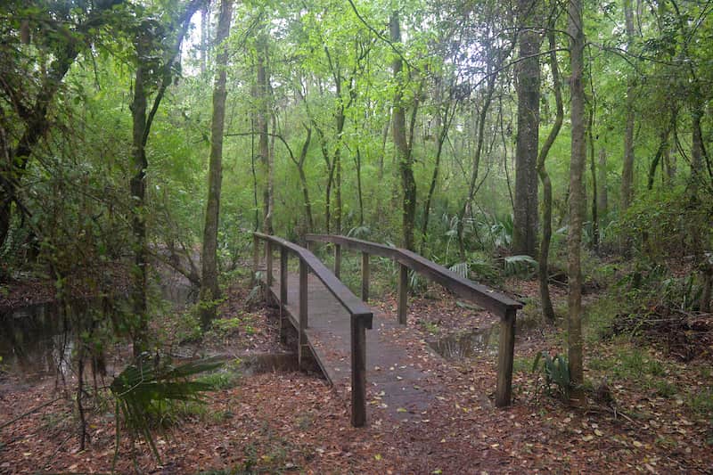
Caney Creek crossing with 48-foot bridge
Caney Creek Camp (0.55 miles south via LLCL detour)
Kelly’s Pond Road (entire length is designated hunter camp)
Features excellent Lake Conroe views and ends at Stubblefield Recreation Area, the trail’s first major resupply point with amenities.
Highlights:
Lake Conroe overlook at mile 16.6
Stubblefield Campground with showers, potable water ($15 camping fee)
Resupply/Services:
Stubblefield Recreation Area (mile 19.7): Potable water, developed campground, showers for paid campers, often staffed with campground host
Water Sources:
Lake Conroe (5 D.R.O.P.S) at mile 16.6
Quicksand Creek (4 D.R.O.P.S) at mile 17.9
West Fork San Jacinto River (5 D.R.O.P.S) at mile 19.7
Bath Section (Miles 19.7-28.8)
Trailheads: #6-#7 area
Includes the Stubblefield Overflow Camp and features Fern Creek, one of the more reliable water sources that held water during the 2011 drought.
Highlights:
Stubblefield Overflow primitive camp at mile 20.3
Multiple road crossings including FM 1374
1.5-mile road walk on Bath Lane
Water Sources:
Fern Creek (3+ D.R.O.P.S) at mile 24.0 – more reliable than most intermittent creeks
Huntsville Section (Miles 28.8-35.0)
Trailheads: #7
Passes through varied terrain including Camelia Lake dam crossing and Alligator Creek. Provides access to Huntsville State Park, the trail’s best resupply option.
Highlights:
West Huntsville Camp with pond at mile 28.9
Camelia Lake dam crossing at mile 32.0 (can be slippery after rain)
Alligator Creek crossing at mile 33.2
Ends at I-45 feeder road parking
Resupply/Services:
Huntsville State Park (mile 35.6): Concession stand (may be open), water and Coke machines; requires 2-mile detour EACH WAY (4 miles total round trip). Good camping with showers. Best resupply option on trail.
Huntsville Post Office: Mail drop option; requires shuttle or 6-mile road walk from Trailhead #7, or hitchhiking
Water Sources:
Camelia Lake (5 D.R.O.P.S) at mile 32.0 – avoid due to fertilizer/pesticides from subdivision
Alligator Creek (4 D.R.O.P.S) at mile 33.2 – shallow sandy spring-fed permanent creek
Water Caching Note: Consider caching water at Trailhead #7 to cover upcoming road walks and dry stretches in Phelps Section.
Phelps Section (Miles 35.0-42.0)
Trailheads: #7-#8
Includes significant road walking: 0.7 miles on I-45 feeder road, 1 mile on Park Road 40, then sections on Evelyn Lane. Water is extremely limited.
Highlights:
Road walk under I-45
Phelps Camp at mile 38.3
High-voltage power line crossings
Ends with 2.4-mile road walk on Four Notch Road
Water Sources:
Small intermittent stream (1/2 D.R.O.P.S) at mile 40.7 – best chance for water in this section, but unreliable
Critical Notes:
Longest dry stretch on trail
Multiple road walks
Cache water at Trailhead #7 if possible
Four Notch Section (Miles 42.0-51.7)
Trailheads: #8-#9
Features the Four Notch Loop Trail system (red markers) and includes the traditional halfway point of the LSHT. Creek crossings can be challenging after rain.
Highlights:
Four Notch Hunters Camp with parking at mile 45.0
Four Notch Loop Trail option (saves 2 miles if taking shortcut)
Traditional LSHT halfway point at mile 48.0
East Four Notch Camp at mile 51.3
Water Sources:
Intermittent creek (2 D.R.O.P.S) at mile 47.0
Boswell Creek (3+ D.R.O.P.S) at mile 48.2 – fairly reliable, difficult crossing when raining
Brandy Creek (1 D.R.O.P.S) at mile 51.1
Pond (3 D.R.O.P.S) at mile 51.5
Big Woods Section (Miles 51.7-62.8)
Trailheads: #9
Begins with a significant 2.7-mile road walk, then enters dense forest. Contains a critical off-trail water source at mile 58.5 that may be the ONLY water between miles 51.5 and 71 in dry conditions.
Highlights:
2.7-mile road walk on FS roads 200, 207, and 202
Big Woods Trail Camp at mile 59.8 (100 yards north on FS202D)
Big Woods Parking Area at mile 62.8
Multiple small creek crossings (usually dry)
Resupply/Services:
Evergreen, TX (around mile 62.8): Small town access via 5-mile road walk from Trailhead #9. Evergreen Baptist Church has given hikers permission to use outside water tap behind sanctuary (5 D.R.O.P.S). Road walk includes: 0.2 miles on Ira Denson Lane, 1.7 miles on John Warren Road (watch for dogs), 0.3 miles on Highway 150 to flashing light at Evergreen, then 2.7 miles on FM 945 to next trailhead.
Water Sources:
Critical off-trail pond (4 D.R.O.P.S) at mile 58.5: Go 100 yards east (left) down fire break, then 30 yards south. In dry conditions, this is the ONLY water between miles 51.5 and mile 71.
Water Caching Note: Consider caching water at Trailhead #9 in very dry seasons.
Magnolia Section (Miles 67.4-73.8)
Trailheads: #10-#11
⚠️ CRITICAL ALERT: The bridge over the East Fork of the San Jacinto River at mile 71.1 is washed out. In times of high water, the crossing is hazardous and can remain so for days. An unmarked, unofficial, and difficult-to-follow detour has been mapped and is available in the LSHT Club Maps section of the club website. Use the detour at your own risk!
Nature of forest changes with many magnolia trees. Most of the walk follows creeks. River crossing requires careful planning.
Highlights:
Magnolia Camp at mile 68.6 (older maps show as “LSHT Camp Site #2”)
East Fork San Jacinto River crossing at mile 71.1 (BRIDGE WASHED OUT)
Iron Ore Trailhead #11 at mile 73.8
Water Sources:
Intermittent stream (1+ D.R.O.P.S) at miles 69.0-69.5 – often has water, but some is runoff from private land with unknown quality; get water at or before mile 69 if possible
East Fork San Jacinto River (5 D.R.O.P.S) at mile 71.1 – shallow sandy permanent creek, water of unknown quality, HAZARDOUS CROSSING WITHOUT BRIDGE
Bridge with intermittent stream (4 D.R.O.P.S) at mile 72.2
Detour Information:
Detour begins at Freeside Lane/FS 2126 (mile 69.9)
Check LSHT Club website for current detour map before departure
High water can make crossing hazardous for days at a time
Big Creek Scenic Section (Miles 73.8-80.8)
Trailheads: #11-#12
Features Double Lake Recreation Area and the designated Big Creek Scenic Area where camping and campfires are prohibited.
Highlights:
Double Lake Recreation Area at mile 75.0 with restrooms, potable water, camping (fee required)
Double Lake Trail Camp at mile 75.7
4 miles following creek with multiple footbridges (can be difficult after heavy rain)
Big Creek Scenic Area (miles 78.6-80.8): No camping or campfires allowed
Elevated tramway at mile 78.6
Big Creek Trail and White Oak Trail intersections
Resupply/Services:
Double Lake Recreation Area (mile 75.0): Potable water, restrooms, developed campground with camping fees
Water Sources:
Double Lake (5 D.R.O.P.S) at mile 75.0
Big Creek/Double Lake Branch (3+ D.R.O.P.S) at mile 75.7 – semi-permanent stream follows for 4 miles
Final Big Creek crossing (5 D.R.O.P.S) at mile 79.7 – Get water here! In very dry conditions, no flowing water for next 13 miles until San Jacinto River
Water Caching Note: Consider caching water at Trailhead #12 in very dry seasons.
Tarkington Bayou Section (Miles 80.8-90.9)
Trailheads: #12-#14
Follows Tarkington Bayou (often bone dry) for approximately 3 miles, then turns southwest on old tramway. Southern portions can be wet and muddy.
Highlights:
Tarkington Trailhead #13 at FM 2666 (mile 82.5)
Tarkington Camp at mile 83.55 (100 yards east of trail)
Trail follows west bank of Tarkington Bayou for 3 miles (never crosses)
Mercy Camp at mile 89.1
Mercy Fire Tower Trailhead #14 at mile 90.9
Water Sources:
Tarkington Bayou (1/2 D.R.O.P.S) at miles 84.2-87.2 – often bone dry
Pond (3 D.R.O.P.S) at mile 85.0 – 50 yards east, dam visible from trail
Small pond (3 D.R.O.P.S) at mile 86.8
Resupply/Services:
Chevron Convenience Store (1 mile south of Trailhead #14 at mile 90.9): Hot breakfast and lunch tacos, usual drinks and snacks. Located at FM-2025 & FM 945 intersection.
Winters Bayou Section (Miles 90.9-96.44)
Trailheads: #14-#15 (END)
The final eastern section runs through ecologically diverse areas including swampy terrain and creek bottoms. Can be very wet and muddy after rain with unavoidable standing water.
Highlights:
Steel truss bridge over East Fork San Jacinto River at mile 92.5
Very muddy area at mile 92.2
Old oil derrick foundations at miles 93.4 and 93.9
Iron bridge crossing Winters Bayou at mile 95.8
Trailhead #15 (END) at mile 96.44 – northwest of Cleveland
Water Sources:
East Fork San Jacinto River (5 D.R.O.P.S) at mile 92.5 – always has water
Hidden pond (3 D.R.O.P.S) at mile 93.95
Winters Bayou (5 D.R.O.P.S) at mile 95.8 – always has water
Water Warning: Southern portions can be extremely wet and muddy after rain with unavoidable standing water.
Trail Logistics
Navigation
Exceptionally well-marked with white blazes and aluminum mile markers (2″x4″ red plates with white diamonds). Difficult to get lost. Note: Older wooden post mile markers should be ignored.
Camping
During Hunting Season (Late September-Early January):
Camping restricted to:
Developed campgrounds (Stubblefield, Double Lake, Huntsville State Park)
Established Hunter Camps
Established trail Primitive Camps
Rest of Year:
Dispersed camping allowed on USFS property
Exceptions: No camping near trailheads or within Big Creek Scenic Area boundaries
Water Management
Critical Challenge: Water is the most challenging aspect of the trail. Sources rated by D.R.O.P.S. system (drought reliability 1-5). Many sources are stagnant ponds.
Essential Equipment:
Water filter/purification system essential
Consider carrying extra capacity (3+ liters)
Recommended Water Caching Locations (especially for eastbound hikers):
Trailhead #7 (covers road walks and Phelps Section dry stretch)
Trailhead #9 (in very dry seasons)
Trailhead #12 (in very dry seasons)
D.R.O.P.S. System Explanation:
💧💧💧💧💧 (5): Withstood 2011 drought
💧💧💧💧 (4): Nearly withstood 2011 drought
💧💧💧 (3): Possibly dries up each summer
💧💧 (2): Likely to dry up each summer
💧 (1): Water present only in wettest times, may be stagnant
Monthly Drought Index: Check LSHT Club website for current LSHT Drought Index to estimate water availability.
Parking & Access
All 15 trailheads offer free parking, accessible via Google Maps as “LSHT Trailhead #(1-15)”. No permits required.
Parking Security Note: Some break-ins reported at Trailhead #15. Clear all valuables from vehicle. Consider parking at Montague Church of Christ (15151 FM1725, Cleveland, TX 77328, call +1-281-745-0398 for permission).
Shuttle Services
Trail shuttles available through Lone Star Hiking Trail Club volunteers (contact via Facebook group)
Local taxi services:
Conroe: CVS Taxi Cab (936)-537-5829
Cleveland: 350 Cab (936)-328-8181
Uber/Lyft spotty in remote areas
Road Walks
Several road walks required, including a 5-mile road walk (longest on trail) between Big Woods and Magnolia sections. All road walks should be considered unmarked.
Current weather and recent rainfall (affects creek crossings and water availability)
LSHT Club Facebook group for recent hiker reports
Known Issues:
East Fork San Jacinto River bridge washout at mile 71.1
Southern portions of trail (Tarkington/Winters Bayou) very muddy after rain
High winds create falling tree/limb hazards
Cell phone service unavailable in some locations (usually available within 1 mile)
Why Hike the LSHT?
This beginner-friendly trail offers an ideal introduction to thru-hiking without overwhelming logistics. The flat, easy terrain with good tree cover makes for comfortable daily mileage (typically 10-24 miles per day for a 4-10 day completion). You’ll experience diverse East Texas ecosystems from pine forests to swampy bayous, all within reach of major urban centers.
The trail’s excellent maintenance, clear marking, and multiple access points make it perfect for: