
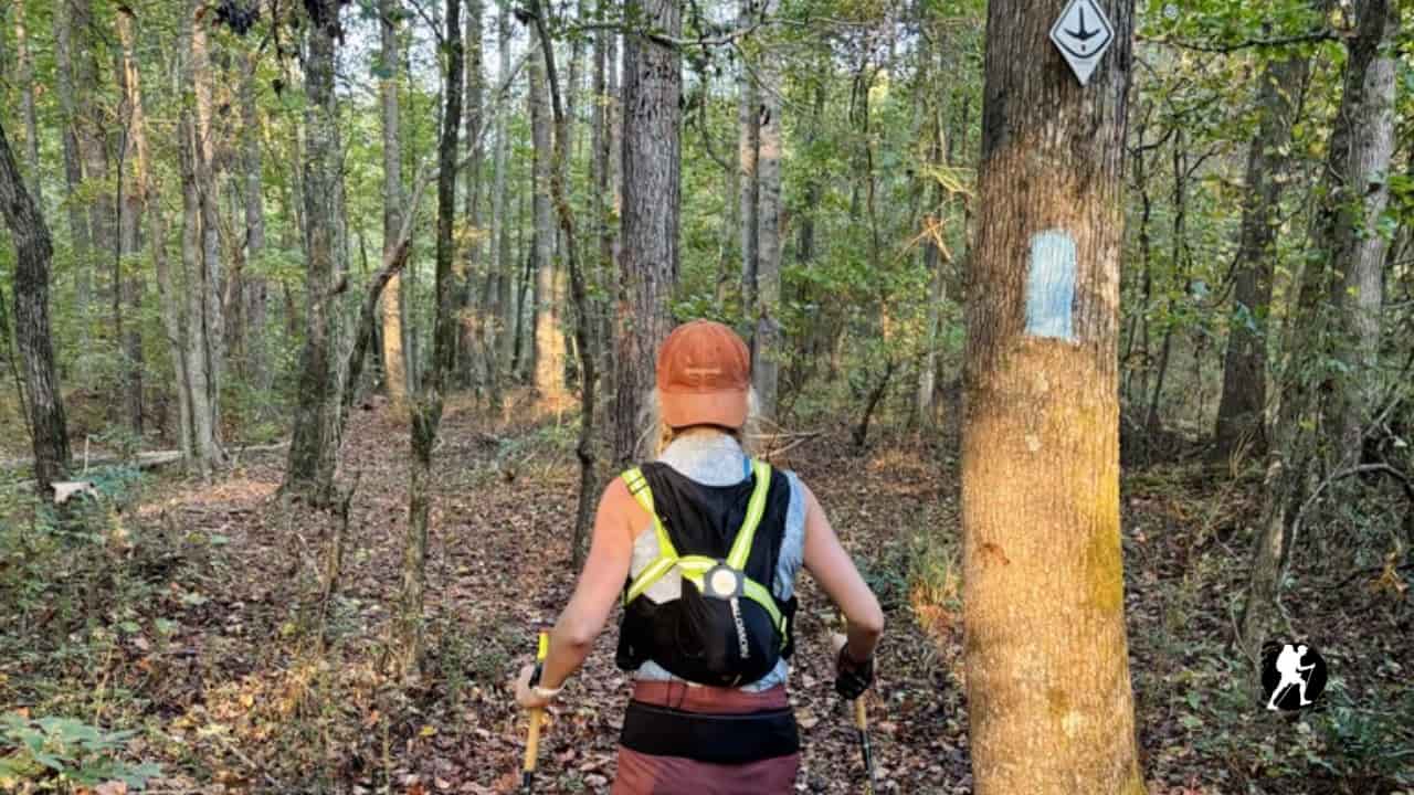
If you’re considering hiking the Pinhoti Trail, one of your first questions is probably: “Will I be able to find my way?” The good news is that the Pinhoti Trail is generally very well marked and suitable for hikers with basic navigation skills. While it doesn’t see the same traffic as famous trails like the Appalachian Trail, the trail blazing and signage are reliable throughout most of the route.
Best Navigation Apps for the Pinhoti
Before you set foot on the trail, download these essential navigation tools:
FarOut is the most popular choice among Pinhoti hikers. This app provides detailed GPS maps that work offline, user comments about trail conditions, water sources, campsites, and real-time location tracking. Many thru-hikers consider it indispensable for staying on course and planning each day’s mileage.
OnX Backcountry is another excellent option that offers comprehensive topographic maps and offline functionality. It’s particularly useful for identifying property boundaries, forest service roads, and alternate routes when needed.
Both apps are worth the modest one time or subscription cost for the peace of mind they provide. Download your maps before starting each section, as cell service is spotty throughout much of the trail.
Trail Blazing in the Forest
When you’re hiking through wooded sections, you’ll primarily follow white rectangular blazes painted on trees at regular intervals. These blazes are typically placed at eye level and appear frequently enough that you should see the next one from where you’re standing.
Pay attention to double blazes, which serve as warning markers. When you see two blazes stacked vertically, expect a turn, junction, or change in direction ahead. The offset of the double blaze sometimes indicates which direction to turn, the higher blaze points toward the upcoming turn.
If you haven’t seen a blaze in 5-10 minutes, stop and backtrack. It’s much easier to relocate the trail by retracing your steps than by continuing forward hoping you’re on the right path.
Navigating Road Walks
The Pinhoti includes several road walk sections, particularly in Alabama. These stretches can be trickier to follow since blazes are less frequent on pavement and roadside structures.
Look for blazes on utility poles, fence posts, guardrails, and roadside trees. The trail maintainers do their best to mark these sections, but occasional fading or obscured blazes mean you’ll rely more heavily on your GPS app during road walks.
Stay alert at intersections. Check your app before turning onto any new road, and look carefully for blazes indicating which direction to continue. Some hikers find road walks monotonous, but they’re also opportunities to resupply in small towns and meet locals.
Forest Service Road Crossings and Junctions
Forest Service (FS) road crossings can be among the most confusing spots on the Pinhoti. Multiple dirt roads may intersect at odd angles, and blazes aren’t always immediately visible after crossing.
At these junctions, stop and look around carefully before proceeding. Blazes are usually placed on trees directly across the road from where the trail enters, but you may need to walk a few steps in different directions to spot them. Your GPS app becomes particularly valuable here.
Some FS road crossings have wooden trail signs or posts, but don’t assume every junction will be marked this clearly. The trail sometimes follows FS roads for short distances before ducking back into the woods, so verify your route rather than automatically crossing every road you encounter.
Additional Navigation Tips
Carry a backup power bank to keep your phone charged. Your navigation app is useless with a dead battery, and this is your primary tool for staying on track.
Take photos at confusing junctions so you can find your way if you need to backtrack. This is especially helpful in areas where the trail splits temporarily or where multiple use-paths converge.
Read recent comments in your trail app. Other hikers often report blowdowns, reroutes, unclear sections, or missing blazes. This community knowledge can prevent hours of frustration.
Learn basic map and compass skills before your hike. While the Pinhoti is well-marked, having traditional navigation knowledge provides a critical safety backup if technology fails.
When You Lose the Trail
Don’t panic if you lose the trail, it happens to everyone. Stop immediately when you realize you’re off-track. Most hikers who get seriously lost compound the problem by continuing forward.
Check your GPS app to see how far off-trail you’ve wandered. If it’s only 50-100 feet, you can usually navigate directly back. If you’ve gone farther, backtrack along your route until you relocate the last blaze you saw, then proceed more carefully.
Final Thoughts
The Pinhoti Trail’s navigation difficulty falls somewhere between easy and moderate. The trail is well-maintained and marked clearly enough that most hikers can follow it successfully with modern GPS apps and basic attention to blazes. While it’s not quite as foolproof as following the crowds on the Appalachian Trail, you don’t need advanced wilderness navigation skills to hike the Pinhoti confidently.
With FarOut or OnX Backcountry on your phone, awareness of blazing patterns, and extra vigilance at road walks and FS road junctions, you’ll spend more time enjoying the beautiful Georgia and Alabama wilderness than worrying about finding your way.