
Wonderland Trail | Circle Mount Rainier’s glaciers and meadows
Plan your Wonderland Trail thru-hike with this section-by-section guide. Learn about resupply options, camps, permits, and what to expect on this 93-mile loop around Mount Rainier.
This website uses affiliate links which may earn a commission at no additional cost to you. As an Amazon Associate I earn from qualifying purchases.
Quick Trail Facts
Difficulty: Hard
Distance: 93 mi
Elevation Gain: 22,000 ft
Longmire – Longmire
Average Time: 9-14 Days
Permit Required?: true
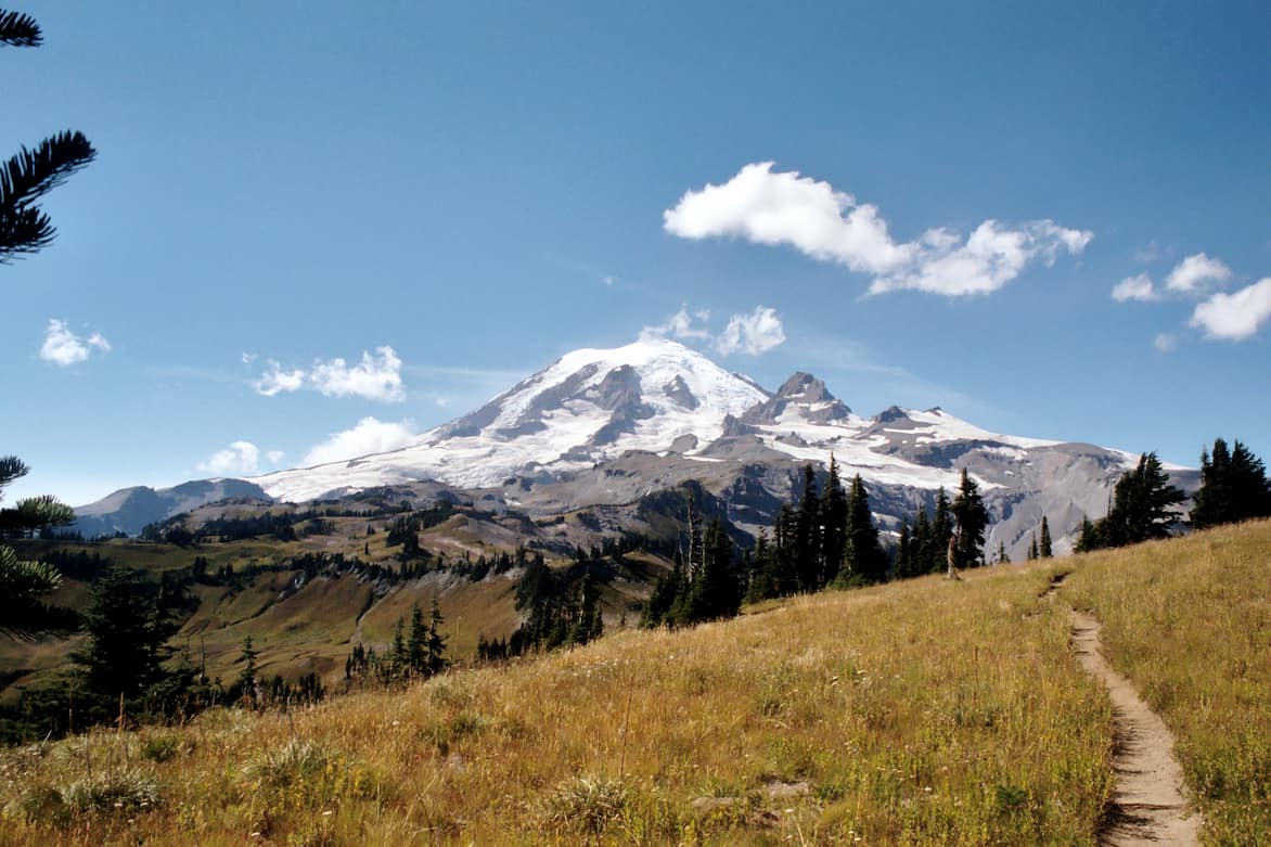
The Wonderland Trail circles Mount Rainier through some of Washington’s most spectacular terrain. This 93-mile loop passes through old-growth forests, crosses glacial rivers, climbs over alpine passes, and showcases 25 named glaciers from every angle of the mountain.
The Route: Clockwise from Longmire
Most hikers tackle the Wonderland clockwise from Longmire, which is considered the traditional route. The trail can be started from several trailheads including Longmire, Mowich Lake, Sunrise, or White River. Below are the sections hiking clockwise from Longmire.
Important: You’ll be camping at designated camps only – there are 18 trailside wilderness camps plus 3 non-wilderness campgrounds spaced 3-7 miles apart. Not all camps have group sites, so parties of 6-12 need to plan accordingly.
Section 1: Longmire to South Puyallup River
Distance: 12.8 miles
Elevation Gain: ~3,600 feet
Camps: Pyramid Creek (3.3 mi), Devil’s Dream (5.8 mi), South Puyallup River (12.8 mi)
The trail begins at Longmire (accessible year-round via Highway 706) and immediately starts climbing. You’ll pass through Pyramid Creek in old-growth forest before reaching Devil’s Dream, where you gain views toward the Klapatche ridge. The descent to South Puyallup River showcases columnar basalt formations. Water is plentiful throughout this section.
Trail Character: Forested with moderate climbing, river crossings on log bridges
Section 2: South Puyallup to Mowich Lake
Distance: 21.4 miles
Elevation Gain: ~6,700 feet
Camps: Klapatche Park (4.1 mi from S. Puyallup), North Puyallup River (2.6 mi), Golden Lakes (5.1 mi), South Mowich River (5.8 mi), Mowich Lake (4.4 mi)
This section features the stunning Klapatche Park with expansive subalpine meadows and glacier views. After dropping to North Puyallup River, you’ll climb to Golden Lakes and traverse Sunset Park before descending to South Mowich River. The final climb brings you to Mowich Lake Campground at 4,939 feet.
Resupply Option: Mowich Lake
Mowich Lake is accessible by road (seasonal, typically mid-July to early October). This is a popular place to cache food or meet support crew. Limited facilities – composting toilets and parking, no water spigots.
Trail Character: Significant elevation changes, meadows, glacier-carved valleys
Alternate Route: From Mowich Lake, you can take the Spray Park alternate (more scenic, higher elevation, often snow-covered into August) instead of the standard Ipsut Pass route.
Section 3: Mowich Lake to Carbon River Area
Distance: 9.6 miles (via Ipsut Pass)
Elevation Loss: ~2,500 feet
Camps: Ipsut Creek (5.6 mi), Carbon River (4.0 mi)
From Mowich Lake, the trail descends via Ipsut Pass through forest to Ipsut Creek Campground at the lowest point on the trail (2,473 feet). Continue to Carbon River Camp with views of the Carbon Glacier – the lowest elevation glacier in the lower 48 states.
Access Note: Carbon River
The Carbon River Road has been closed to vehicles for years due to flood damage. Ipsut Creek Campground is now accessed by hiking or biking ~5 miles on the old road. This limits road access for resupply but rangers may assist with food cache pickup at Carbon River Ranger Station (check current policies).
Trail Character: Rainforest environment, suspension bridges, lush and green
Section 4: Carbon River to Sunrise
Distance: 18.0 miles
Elevation Gain: ~6,600 feet
Camps: Dick Creek (1.3 mi), Mystic Camp (3.7 mi), Granite Creek (4.1 mi), Sunrise Camp (4.6 mi)
This is a significant climbing section on the north side of the mountain. From Carbon River, climb through forest to Dick Creek, then continue ascending to Mystic Camp at 5,595 feet. Granite Creek sits at nearly 6,000 feet before you reach Sunrise Camp at the highest campsite elevation (6,256 feet).
Trail Character: Sustained climbing, alpine environments, potential snow fields into August, stunning mountain views
Wildlife: Excellent area for spotting mountain goats and marmots
Section 5: Sunrise to Summerland
Distance: 10.5 miles
Camps: White River Campground (3.5 mi from Sunrise), Summerland (7.0 mi from White River)
From Sunrise Camp, descend to White River Campground (a front-country campground with full facilities). This is a major trailhead and access point. From White River, climb steadily through forest and meadows to Summerland, one of the trail’s most popular camps with wildflower meadows and glacier views.
Major Resupply: White River Campground
White River Campground (elevation 4,353 ft) is accessible by paved road. Great spot for food cache pickup with real bathrooms, parking, and a seasonal ranger station. No store, but full campground facilities available.
Trail Character: Mix of forest and subalpine meadows, moderate climbing
Section 6: Summerland to Longmire (via the Southeast)
Distance: 25.2 miles
Elevation: Up and over Panhandle Gap (6,750 ft)
Camps: Indian Bar (4.7 mi), Nickel Creek (6.8 mi), Maple Creek (3.6 mi), Paradise River (7.3 mi), back to Longmire (3.6 mi)
From Summerland, climb to Panhandle Gap, the trail’s highest point with incredible views. Descend to Indian Bar with its historic stone shelter. Continue down to Nickel Creek in the Stevens Creek drainage. Climb again to Maple Creek, then traverse to Paradise River before the final descent to Longmire.
Side Trip: Paradise
The trail passes near Paradise, the most visited area in the park with the Henry M. Jackson Visitor Center, food service, and lodging at Paradise Inn (seasonal). It’s a ~1 mile detour from the Wonderland Trail via connecting trails. Box Canyon and Reflection Lakes offer additional road access points.
Trail Character: Extreme elevation changes, exposed alpine terrain at Panhandle Gap (can be snowbound), forested river valleys, some of the trail’s most dramatic scenery
Note: Panhandle Gap often holds snow into late summer – bring microspikes and check conditions
Resupply & Town Options
The Wonderland Trail doesn’t pass through any towns, but there are several options for food caching and resupply:
Primary Resupply Points
Mowich Lake (Mile 34.3): Seasonal road access. Cache food here or meet support. Limited to parking lot and composting toilets.
White River Campground (Mile 60.3): Full road access year-round (when roads are open). Front-country campground with facilities. Most popular cache location. Ranger station for permit questions.
Carbon River Ranger Station: Accessible via Carbon River Road (currently closed to vehicles, requiring 5-mile bike/hike). Some hikers arrange cache pickup with rangers – call ahead to confirm current policy.
Near-Trail Access
Longmire (Start/Finish): National Park Inn (lodging, restaurant, small gift shop), ranger station, wilderness information center. No grocery store.
Paradise: Paradise Inn (seasonal lodging and dining), Jackson Visitor Center, small café. Accessible via short spur from trail near Reflection Lakes.
Gateway Towns (Outside the Park)
Ashford (6 miles west of Nisqually entrance): Gas, small grocery, restaurants, lodging. Closest grocery to Longmire trailhead.
Packwood (13 miles southeast): Full grocery store, restaurants, hotels, outdoor gear shop. Good pre-trip provisioning stop.
Enumclaw (45 miles from Sunrise/White River): Larger town with full services, grocery stores, gear shops. Good option for staging before starting from the east side.
Caching Strategy: Most hikers use a two-cache system – one at Mowich Lake or Carbon River (around day 3-4) and one at White River (around day 6-7). This lets you carry 3 days of food at a time instead of the full trip weight. Caches must be dropped off in person before your hike starts.
Essential Planning Tips
Permits are competitive. Apply for the lottery in early spring (typically March) or try for first-come, first-served walk-up permits (30% of spots held). Plan your itinerary carefully based on your hiking pace – the constant elevation change makes mileage feel harder than expected.
Know your abilities. Honestly assess how far you can hike per day with elevation gain. Many hikers overestimate, leading to exhaustion or inability to reach their permitted campsite. A 10-mile day with 3,000 feet of climbing is much harder than a flat 10 miles.
Snow lingers. Even in mid-July, expect snow on higher passes, especially Panhandle Gap and potentially Spray Park. Bring microspikes and know how to use them. Many river crossings are on primitive log bridges that can wash out.
Bear safety. All camps have bear poles for hanging food. Black bears are common. Practice hanging your food at home before the trip.
Water is abundant. You’ll cross numerous streams and rivers. A simple filter (Sawyer Squeeze is popular) is sufficient. No need to carry excessive water weight between sources.

When to Hike
The Wonderland is typically snow-free from mid-July through September. Before mid-July, you’ll need winter travel skills including ice axe, crampons, and river crossing expertise. By October, new snow returns and conditions deteriorate rapidly.
Peak season is late July through August when wildflowers bloom in subalpine meadows and weather is most stable. However, this is also when permits are hardest to obtain and camps are fullest.
Shoulder season (late September) offers solitude and fall colors but shorter days, colder nights, and unpredictable weather. Some facilities close after Labor Day.
Before You Commit
The Wonderland Trail is not a beginner backpacking trip. It’s strenuous, remote, and committing. If you’re new to backpacking, consider doing a 2-3 day section first to test your gear, fitness, and interest. Popular starter sections include:
- Longmire to Klapatche Park (out and back or one-way with shuttle)
- White River to Summerland and Indian Bar
- Mowich Lake to Carbon River via Ipsut Pass
These shorter trips let you experience the trail’s character without the full commitment. If you love it, you’ll be better prepared for the full loop.